
Chapter 6 Sustainabilty and Engineering: Green Infrastructure#
1. Introduction#
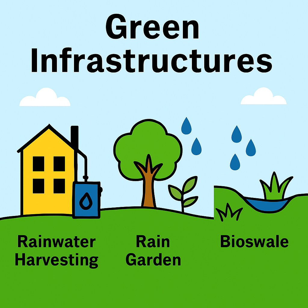
Fig. 37 **Figure 6.2 **: Green Infrastructures#
🌿 Green Infrastructure and Natural System Recovery#
🧭 Definition of Green Infrastructure#
Green infrastructure refers to strategically planned networks of natural and semi-natural systems—such as vegetation, soils, wetlands, and permeable surfaces—that mimic or restore natural processes to manage water, improve air quality, and support biodiversity.
According to the US EPA, it includes practices like rain gardens, bioswales, permeable pavements, green roofs, and urban tree canopies that store, infiltrate, evapotranspirate, and filter stormwater.
🌎 How Green Infrastructure Supports Natural Functions#
Green infrastructure helps restore and enhance ecosystem services by:
🌧️ Minimizing runoff: Allows water to infiltrate into soil, reducing surface flow and erosion.
💧 Promoting infiltration and evapotranspiration: Recharges groundwater and maintains hydrological cycles.
🧪 Filtering and retaining pollutants: Vegetation and soil microbes absorb and break down toxins.
♻️ Assimilating and recycling harmful substances: Supports nutrient cycling and microbial degradation in soil and water.
🌳 Enhancing biodiversity: Provides habitat and connectivity for flora and fauna.
⚠️ Human System Designs That Degrade Natural Functions#
Design Practice |
Impact on Natural Systems |
|---|---|
Impervious surfaces (roads, roofs) |
Prevent infiltration, increase runoff and flooding |
Channelized drainage systems |
Disrupt natural hydrology and sediment transport |
Monoculture agriculture |
Reduces biodiversity, increases erosion and runoff |
Chemical-intensive land use |
Pollutes soil and water, harms microbial life |
Deforestation and land clearing |
Reduces evapotranspiration, destabilizes soil |
Urban heat islands |
Alters microclimates, stresses vegetation |
🔧 Strategies to Recover Natural Functioning#
🌱 Passive and Active Restoration#
Passive: Cease harmful activities and allow natural recovery.
Active: Reintroduce native species, reshape hydrology, and amend soils.
💡 Nature-Based Solutions#
Rain gardens & bioswales: Capture and filter runoff.
Permeable pavements: Enable infiltration and reduce heat.
Green roofs & walls: Promote evapotranspiration and insulation.
Wetland restoration: Reestablish hydrology and pollutant filtration.
🧬 Soil and Microbial Recovery#
Add compost and organic matter to restore microbial communities.
Use phytoremediation and bioaugmentation to detoxify soils.
🌳 Vegetation and Habitat Restoration#
Plant native species to stabilize soil and support biodiversity.
Remove invasive species through ecological means (e.g., controlled burns, predator reintroduction).
🌀 Hydrological Reconnection#
Reconnect floodplains and remove barriers to natural water flow.
Restore meanders and riparian buffers to enhance sediment and nutrient cycling.
🌎 Functions and Performance#
Function |
Description |
|---|---|
🌧️ Runoff Reduction |
Captures and infiltrates stormwater to reduce flooding and erosion |
💧 Groundwater Recharge |
Promotes infiltration to replenish aquifers |
🧪 Pollutant Filtration |
Removes nutrients, metals, and toxins via soil and vegetation |
🌬️ Air Quality Improvement |
Vegetation absorbs pollutants and cools urban heat islands |
🐝 Habitat Creation |
Supports biodiversity and ecological connectivity |
♻️ Nutrient Cycling |
Enhances microbial and plant-based recycling of harmful substances |
EPA studies show GI practices like bioswales, permeable pavements, and rain gardens can reduce runoff volumes by 30–90% and remove up to 80% of suspended solids.
📈 Current Trends in the U.S.#
Urban retrofits: Cities like NYC and Detroit are converting alleys and rooftops into green spaces
Equity-focused planning: GIequity.org highlights disparities and promotes inclusive GI governance
Climate resilience: GI is central to adaptation plans in Boston, New Orleans, and Boise
Technology integration: AI and modeling tools (e.g., SWMM, VELMA) support site-specific GI design
🥇 Top Strategies Used in the U.S.#
Strategy |
Description |
|---|---|
🌱 Rain Gardens & Bioswales |
Capture and filter runoff in urban landscapes |
🏞️ Urban Forests & Tree Canopies |
Reduce heat, absorb pollutants, and intercept rainfall |
🧱 Permeable Pavements |
Allow water to infiltrate, reducing runoff and cooling surfaces |
🏢 Green Roofs & Walls |
Promote evapotranspiration and insulation |
🌊 Wetland & Floodplain Restoration |
Reconnect natural hydrology and improve water quality |
🧬 Soil Amendments & Native Plants |
Enhance infiltration and pollutant breakdown |
🧰 Integrated Modeling Tools |
Use EPA’s SWC, Green Values Calculator, and VELMA for design optimization |
🧠 Summary Insight#
Green infrastructure in the U.S. is evolving from isolated stormwater fixes to multi-functional, climate-resilient systems. It restores the natural capacity of ecosystems to filter, absorb, and recycle, while also addressing social equity, urban livability, and long-term sustainability.
Green infrastructure is not just a technical fix—it’s a philosophical shift toward designing with nature rather than against it. It reestablishes the self-regulating capacity of ecosystems, enabling them to filter, cycle, and heal—functions that are foundational to long-term resilience and sustainability.
References#
[Benedict and McMahon, 2006] is widely regarded as the definitive primer on green infrastructure in the U.S. It introduced the concept as a landscape-scale planning framework that integrates ecological health with human development needs. The book covers principles of green infrastructure from past to present; Benefits of ecological network design; Planning and implementation strategies; Stewardship and community engagement; Case studies from across the U.S.
This interactive tool models the effects of various green infrastructure (GI) elements on urban stormwater runoff. It helps planners, engineers, and sustainability advocates visualize how features like rain gardens, green roofs, and permeable pavements contribute to managing water in a more sustainable and decentralized way.
Purpose#
Estimate how green infrastructure reduces stormwater runoff during a rainfall event
Visualize retained vs. untreated runoff based on GI surface area
Help guide land use planning, retrofits, and low-impact development (LID) strategies
Core Concepts#
Variable |
Description |
|---|---|
|
Design storm depth (in millimeters) |
|
Total area contributing runoff (m²) |
|
Percent of rainfall retained by each GI element |
Inputs Controlled via Sliders#
Rain Garden Area (m²) – vegetated depressions to absorb runoff
Green Roof Area (m²) – living roof systems that retain rainfall
Permeable Pavement Area (m²) – paving systems allowing infiltration
Each slider lets users define GI surface areas from 0 to 1000 m².
Calculation Steps#
Estimate total runoff volume from rainfall over catchment
Use GI area and retention coefficients to compute retained water
Calculate net runoff volume (total runoff − retained volume)
Display a pie chart comparing retained vs. remaining runoff
Outputs#
Visual pie chart illustrating percentage of water retained
Text summary:
Total design storm volume
Total GI area installed
Volume retained by GI measures
Remaining untreated runoff
Use Cases#
Urban stormwater planning and modeling
Site-scale sustainability assessments
Green infrastructure sizing for streets, campuses, neighborhoods
Support for LEED, SITES, and climate resilience design
2. Simulation#
import numpy as np
import matplotlib.pyplot as plt
from ipywidgets import FloatSlider, IntSlider, interact

# 🧮 Retention coefficients for GI features (% of rainfall retained)
efficiency = {
    'rain_garden': 0.5,     # 50% of rainfall retained
    'green_roof': 0.6,
    'permeable_pavement': 0.4
}

# 🌿 Main function to simulate GI impact
def simulate_GI(rainfall_mm, catchment_area_m2,
                rain_garden_area, green_roof_area, permeable_pave_area):

    total_gi_area = rain_garden_area + green_roof_area + permeable_pave_area

    gi_retained = (
        rain_garden_area * efficiency['rain_garden'] +
        green_roof_area * efficiency['green_roof'] +
        permeable_pave_area * efficiency['permeable_pavement']
    )

    total_runoff = catchment_area_m2 * rainfall_mm / 1000  # m³
    retained_volume = gi_retained * rainfall_mm / 1000     # m³
    net_runoff = total_runoff - retained_volume

    # 🌧️ Pie chart
    labels = ['Retained by GI', 'Remaining Runoff']
    values = [retained_volume, net_runoff]
    plt.figure(figsize=(6, 4))
    plt.pie(values, labels=labels, autopct='%1.1f%%', colors=['green', 'blue'], startangle=120)
    plt.title("Stormwater Management with Green Infrastructure")
    plt.tight_layout()
    plt.show()

    print(f"🌧️ Design Storm Volume: {total_runoff:.1f} m³")
    print(f"📏 Catchment Area: {catchment_area_m2:.0f} m²")
    print(f"🌿 Total Green Infrastructure Area: {total_gi_area:.0f} m²")
    print(f"💧 Estimated Volume Retained: {retained_volume:.1f} m³")
    print(f"🚿 Net Runoff After GI Treatment: {net_runoff:.1f} m³")

# 🎛️ Interactive sliders
interact(simulate_GI,
         rainfall_mm=FloatSlider(value=50, min=10, max=150, step=5, description='Rainfall (mm)'),
         catchment_area_m2=IntSlider(value=1000, min=100, max=5000, step=100, description='Catchment Area (m²)'),
         rain_garden_area=IntSlider(value=200, min=0, max=2000, step=50, description='Rain Garden (m²)'),
         green_roof_area=IntSlider(value=300, min=0, max=2000, step=50, description='Green Roof (m²)'),
         permeable_pave_area=IntSlider(value=300, min=0, max=2000, step=50, description='Permeable Pavement (m²)'));
3. Self-Assessment#
Conceptual Questions#
These questions explore the physical principles and modeling logic behind the simulation.
Hydrologic Concepts#
What is the relationship between rainfall depth, catchment area, and total runoff volume?
Why is runoff volume calculated using the formula ( \text{Area} \times \text{Rainfall} / 1000 )?
How do retention coefficients represent the effectiveness of different GI features?
GI Performance Modeling#
Why is the retained volume calculated as a product of GI area and retention efficiency?
How does increasing GI area affect net runoff?
What assumptions are made about uniform rainfall distribution and GI performance?
Visualization & Interpretation#
What does the pie chart reveal about the proportion of runoff managed by GI?
Why might permeable pavement have a lower retention coefficient than green roofs?
How could this model be adapted to simulate multiple storm events or seasonal variation?
🔍 Reflective Questions#
These questions encourage critical thinking and application to real-world urban design and sustainability.
Which GI feature would be most effective for your local climate and land use?
How would the results change if the rainfall intensity increased due to climate change?
What are the trade-offs between space allocation and retention efficiency in GI planning?
How could this model support municipal stormwater management decisions?
What limitations exist in using fixed retention coefficients for dynamic hydrologic systems?
❓ Quiz Questions#
Multiple Choice#
Which GI feature has the highest retention efficiency in this model?
A. Rain Garden
B. Green Roof
C. Permeable Pavement
D. Bioswale
Answer: BIf rainfall is 100 mm and catchment area is 1000 m², what is the total runoff volume?
A. 10 m³
B. 100 m³
C. 1000 m³
D. 1 m³
Answer: BWhich factor most directly reduces net runoff in the simulation?
A. Catchment area
B. Rainfall depth
C. GI area and efficiency
D. Soil type
Answer: C
True/False#
Increasing green roof area will reduce net runoff.
Answer: TrueRetention coefficients are expressed as percentages of rainfall retained.
Answer: TrueThe model accounts for infiltration and evapotranspiration.
Answer: False
Short Answer#
Explain how the model calculates the volume of water retained by GI features.
Answer: It multiplies the area of each GI feature by its retention coefficient and the rainfall depth, then sums the results.Why might the actual retained volume differ from the model’s estimate?
Answer: Factors like soil saturation, maintenance, slope, and rainfall intensity can affect real-world retention performance.